Please note: all swims are at our own risk. Including a location does not indicate that it is safe; we must do our own risk assessment. Swim Safety info on this website.
See Itinerary for Herts, Beds, Northants 9-12 August
Location info via the Places page
Saturday 10 August
Wellingborough
Possible swim spot – 2010 press article mentions the locks near Embankment

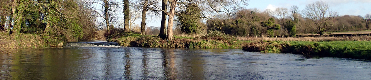
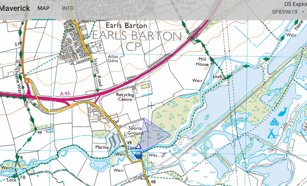
Earls Barton, SW of Wellingborough
From car park walk to river. Shallow entry at end of path, or turn right and go in at the second fishing platform.
Great Ouse swims

Places people swim in the area, flOusies Google map – with thanks! Note that this shows places they swim (plus one I have added), not recommendations that they are safe. We all take responsibility for our own safety and assessment.
The group also do OuseTreks, when they swim a stretch of the river together (at own risk), and have put together a fantastic Google map of the routes
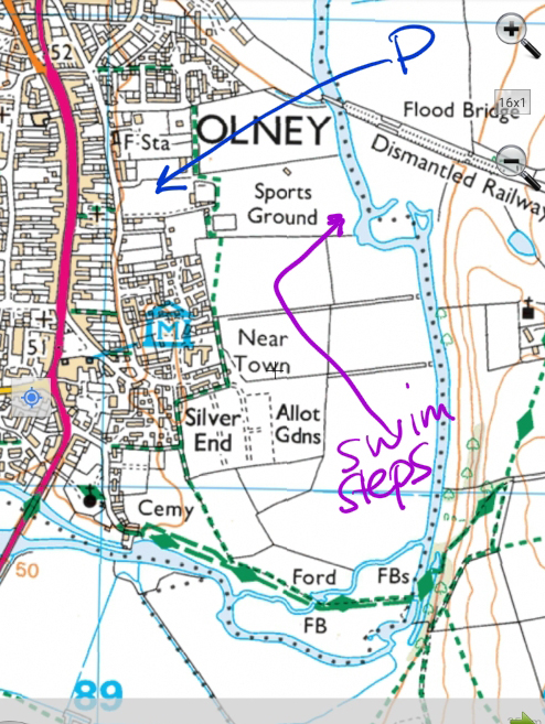
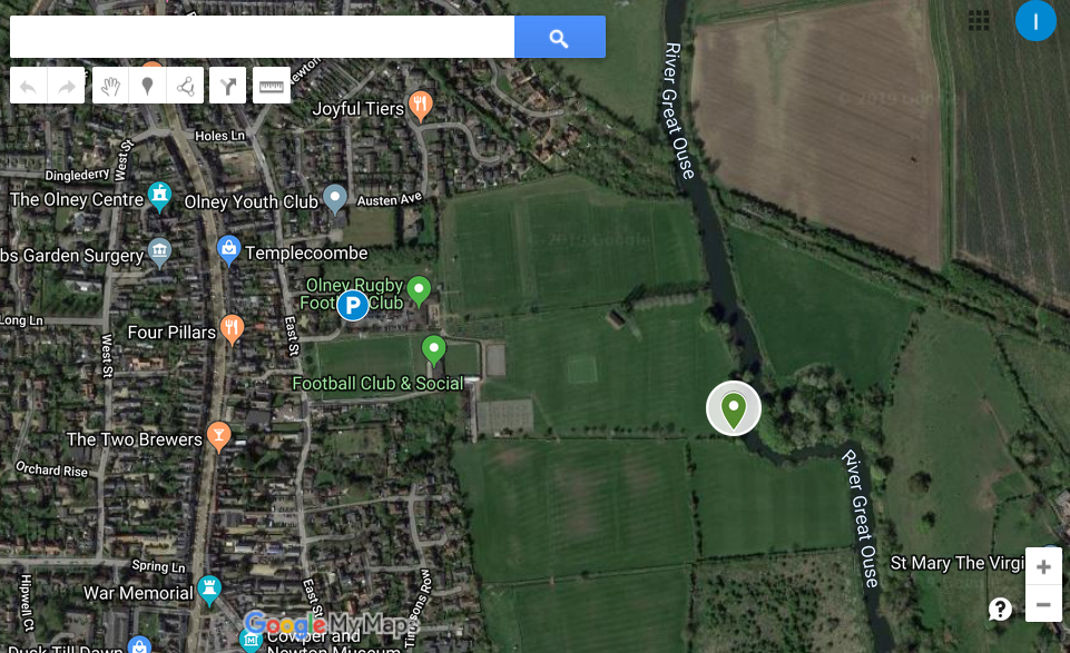
Olney
Tyringham Bridge

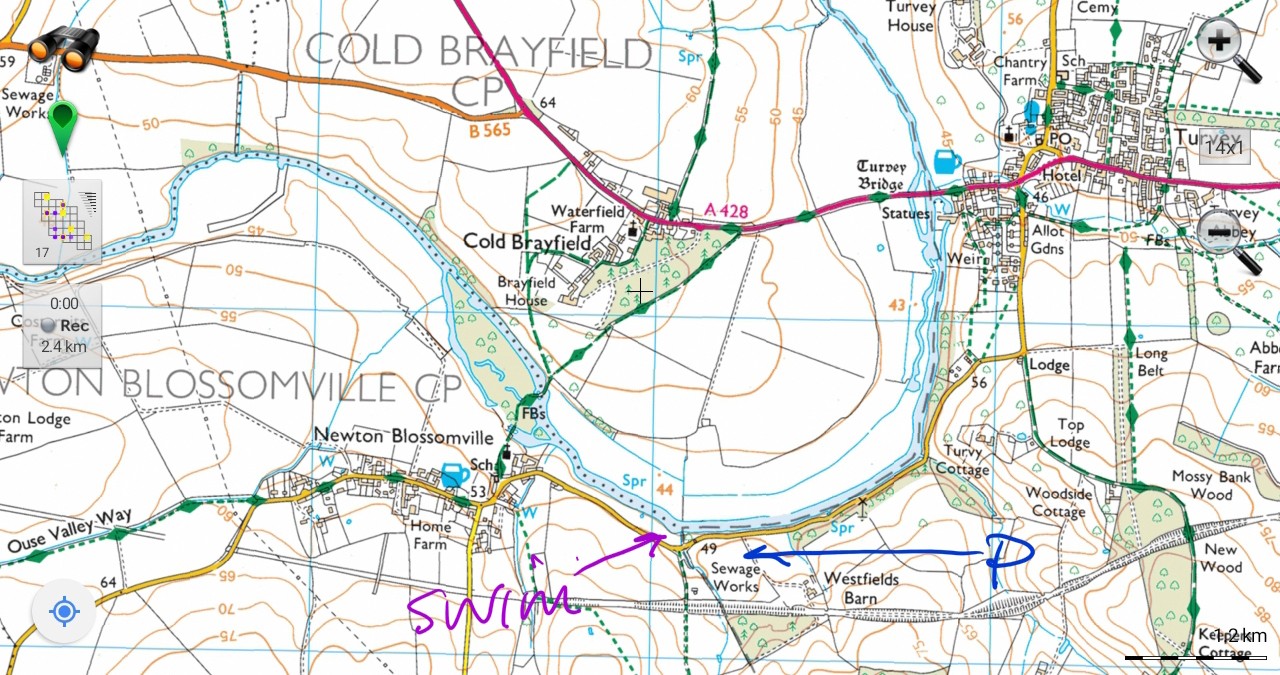
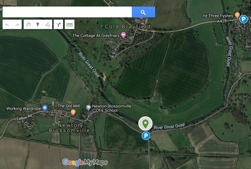
Newton Blossomville
Harrold Mill/Odell
Parking on north side of bridge, east side of road. Walk down path towards bridge, to shallow entry from beaches. Mostly shallow, with a deep pool with weir. Take care in the white water, and follow the usual safety guidelines.
There have been drownings here, most recently in 2018, so there are likely to be local sensitivities. But it is not clear why the place is any more dangerous than other outdoor spots.

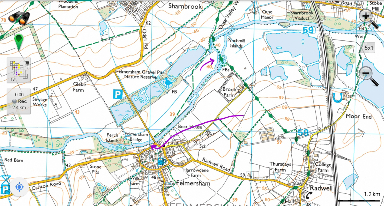
Harrold Mill/BridgeFelmersham and Pinchmill Islands
Easy access by bridge on slipway.
It is worth a walk (or kayak/canoe) to Pinchmill Islands for a lovely place to swim in small pools, paddle and explore. There is only one small sign saying No swimming or paddling, which can easily be ignored.
About Pinchmill Islands on local website
And exact location: Grid Ref: SP 9969 5886 • X/Y co-ords: 499699, 258866 • Lat/Long: 52.21900177,-0.54203679
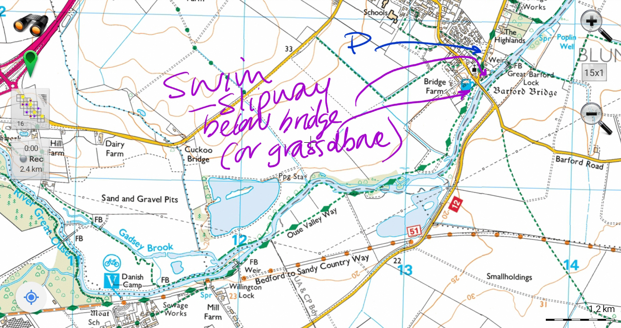
Great Barford
Great Barford on wild swim map
Park by the church, enter by slipway by bridge, or from grass above bridge, on the north bank.

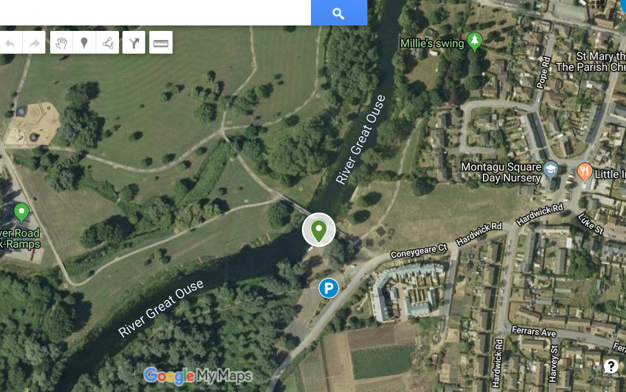
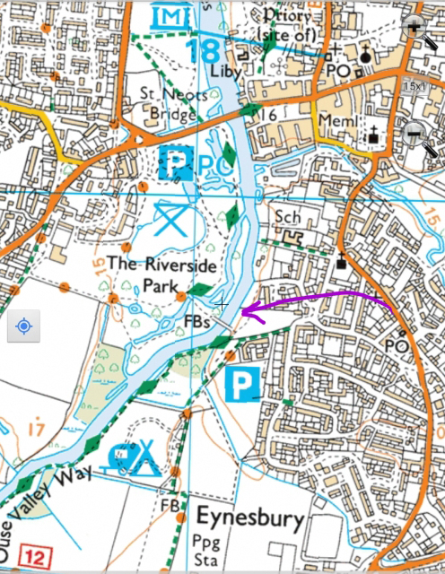
St Neots
(Eynesbury/Coneygeare/Riverside Park)
There are inaccurate and unhelpful signs saying No Swimming, but as a navigable water and public land there can be no enforceable ban here. Take care about boats, the current, and take the usual safety precautions.
See Itinerary for Herts, Beds, Northants 9-12 August
Location info for other days:
Fri 09.08.19 Nene, Welland and nearby
Sun 11.08.19 Beds venue, river, lidos
Mon 12.08.19 Beds & Herts lidos, river, lake
Please note: all swims are at our own risk. Including a location does not indicate that it is safe; we must do our own risk assessment. Swim Safety info on this website.