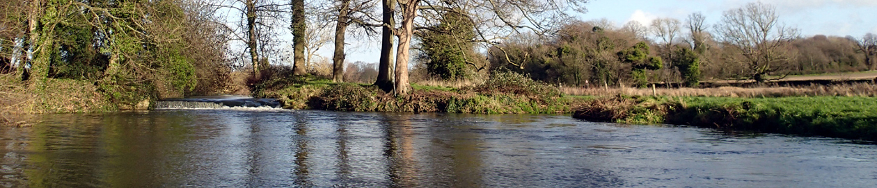
Trowse Meadow
The waters running through the meadow north of Whitlingham Lane and and the river Yare is managed by the Broads Authority and is navigable, therefore there is a right to swim in the river. The land has a different management – see below. The rivers are complicated here. Two branches of the river Yare come down from  the mill and join halfway along the meadow, then another small stream joins at the end. Further down the Yare is joined by the Wensum, and carries on as the Yare towards Great Yarmouth. Somewhere above the mill the river Tas joins one of the branches of the Yare.
UPDATE late summer 2022: Trowse Meadow CLOSED by the Whitlingham Trust, the Colemans family organisation that owns and manages several waterways in this area and hates people swimming unless they pay for it. This was done without notice and without consulting the parish council or making any attempt to liaise with swimmers who always have a positive influence at busy swim spots where there could be minority antisocial behaviour. Various reasons given, none of them credible. You can still swim at Trowse Mill and in the river Yare.
UPDATE May 2023: Some had been swimming down from the bridge, after the meadow was blocked off, but sadly that experience has been ruined by utterly insensitive – potentially illegal – wholesale tree felling on both sides of development area and alongside the meadow. https://www.bbc.co.uk/news/av/uk-england-norfolk-65432244
ORIGINAL POST:
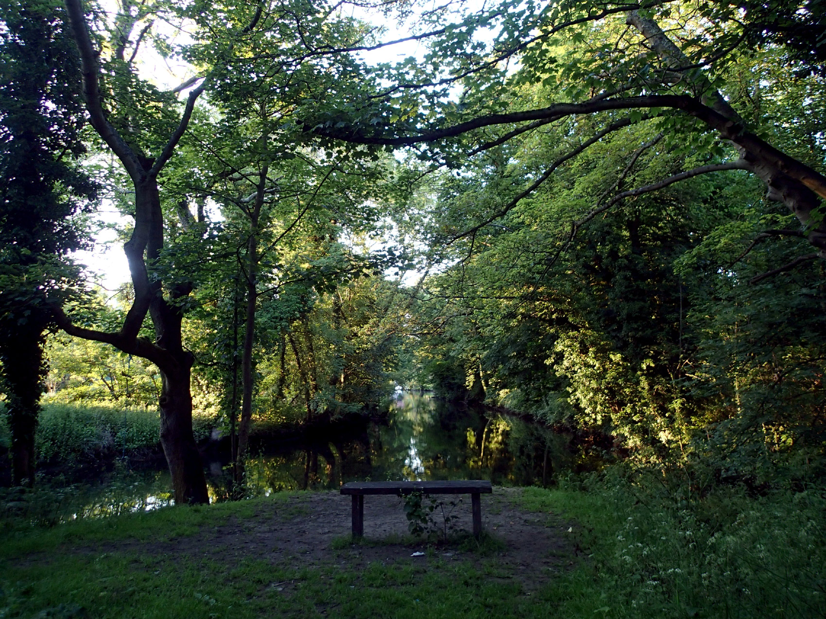
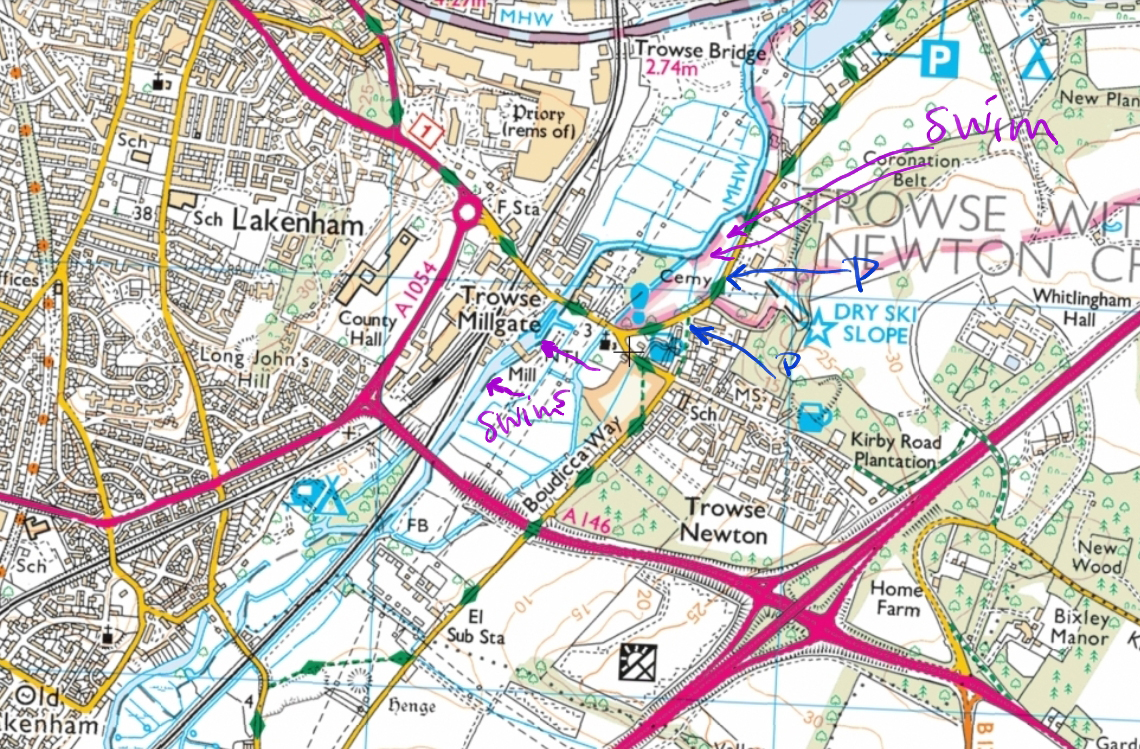
At the end of the meadow where a small stream joins is obviously a swim spot with rope swing and well-worn tree roots to climb in and out (though not all will find that easy, especially if it is wet), and a bench. 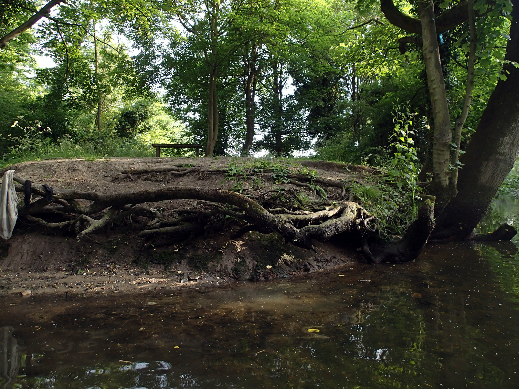 The mud on the edge is a bit squidgy. Shallow at first, but soon deepens into a good swimming depth. From here you can swim upstream along the meadow, then fork right to swim up towards the mill and The Street/ Bracondale Road. The whole stretch is mostly deep and clear, but there are more weeds as you get further towards the bridge.
You can get in and out at various points along the meadow – by the roots of an ash tree with a rope swing, by the boardwalks, and at the corner where the other branch of the river joins. If you carry on upstream to the right there are no easy get out points, and you can’t get in along that stretch. (You can carry on up the stream to the left, but it is quite weedy at the moment, and I’m not sure how deep it is.)
Cows can be in Trowse meadow, so entry points and grass might be mucky and trampled, or you might need to leave clothes with care!
Be aware it is tidal so sometimes there is water on the meadow, and this can affect water quality (cowpats!). Head up swim if in doubt.
The field can be flooded at high tide, which coincides with full or new moon, when you might expect water level of river above the banks at highest time, or wet and muddy at other times, and debris in the water. With removal of the bridge opposite the ski centre it is a long muddy walk from the remaining entry points.
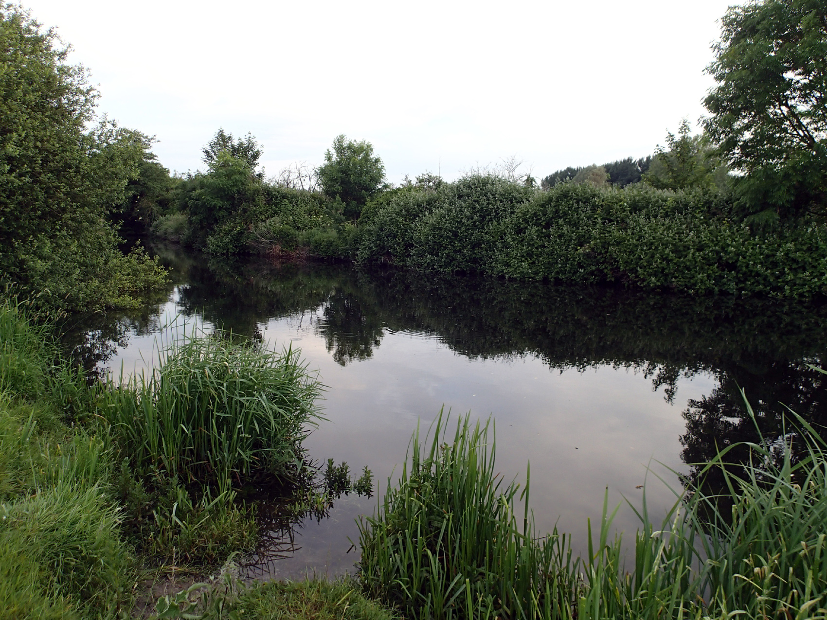
(There might be a good swim downstream to where the Wensum feeds into the Yare, but it is bounded by private gardens and a boat club, so getting out might be problematic except in an emergency, so probably best for strong swimmers as you have to return against the current.) Note: these are the original directions – see above for update. Meadow closed.
EARLIER CLOSURE:
Note that the entry to the meadow has been reduced by the managers to two points: opposite the church, and a little way along, before the first P on the map. The footbridge opposite the ski centre has been removed.
Later the bench was removed and the second entry point. SEE UPDATE ABOVE – now all entry points have been closed. It is understood that many people still enter the meadow to swim and enjoy it, however without most of the responsible swimmers who would have provided a responsible presence and help practically such as by litter picking.
STILL POSSIBLE:
You can also swim at the far end of Whitlingham Lane. Cross the road from the car park, walk further along the road through the picnic areas to find a choice of beaches. Or you can go back along the road a little way, make your way through the trees, then get in down the bank. This part of the river has boats, so be aware of them and make sure they can see you.

Trowse mill
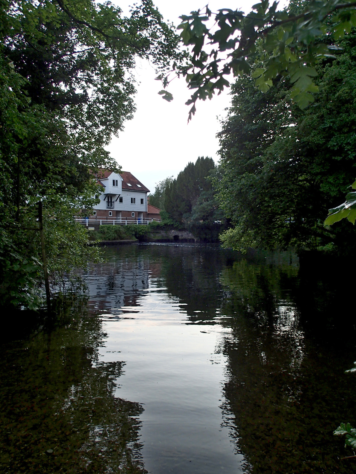
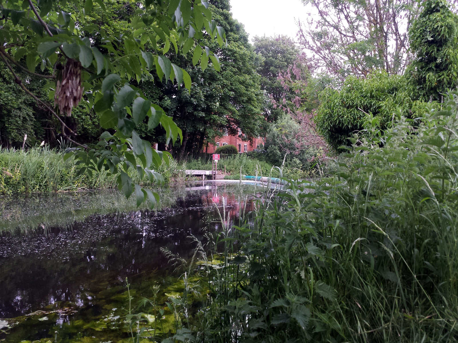
Take a small footpath off The Street along the river until you see a small beach. Shoes recommended. Easy shallow entry, then a deep large pool, with some weeds on the left-hand edge, also if you go down the other branch of river the far side from the beach there are some weeds coming up (early June).
TG2439006870
Lat,Long (OSGB36) 52.612813,1.314819
what3words funny.begins.audit
There are possible swim stretches further up above the mill. If you live in or know someone who lives in Bracondale Millgate or in the mill you might be able to get private access to the platform and ladder above the weir. Otherwise you can carry on up the same small footpath and get in down the bank by a tree opposite. There are clear stretches and areas where water lilies are beginning to get big, so this is probably not ideal for summer swimming.
Trowse mill on the Norfolk mills website
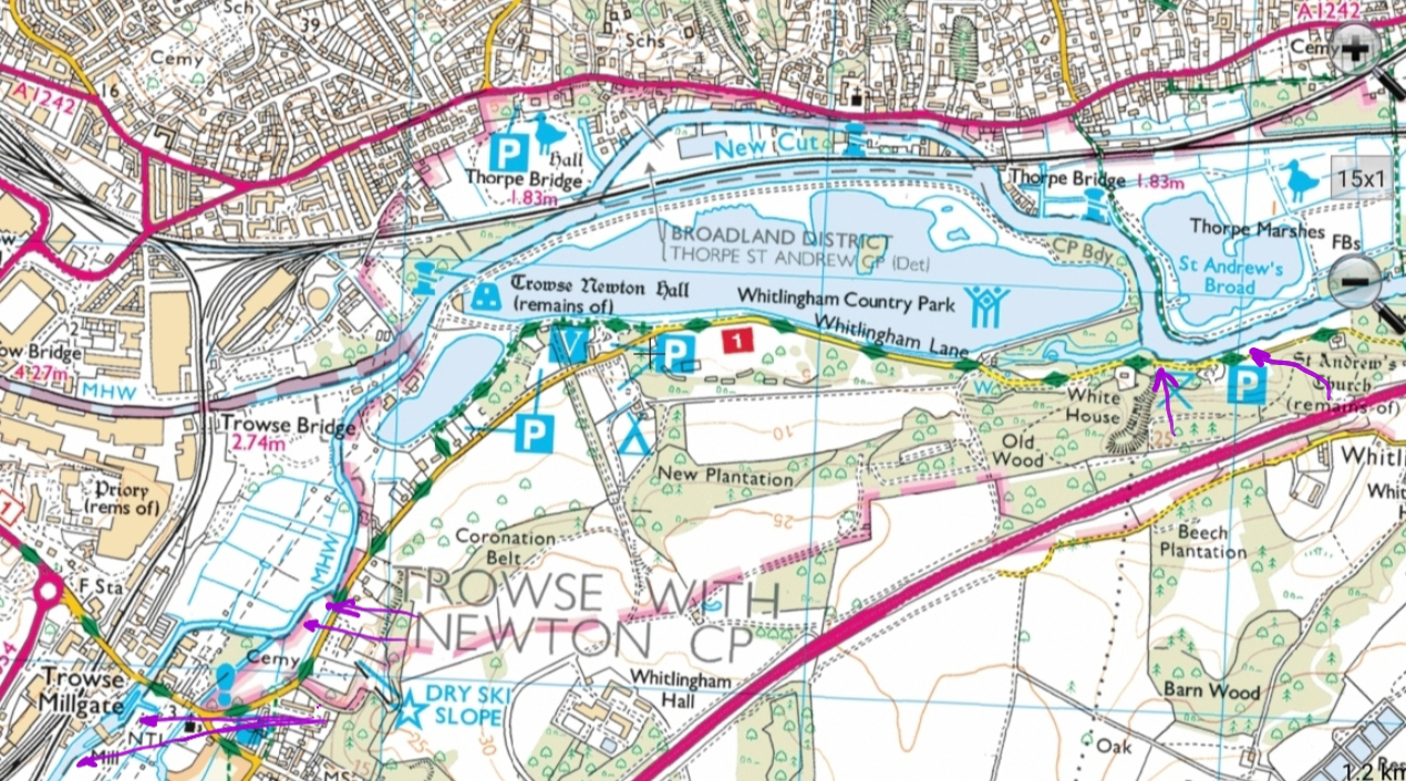
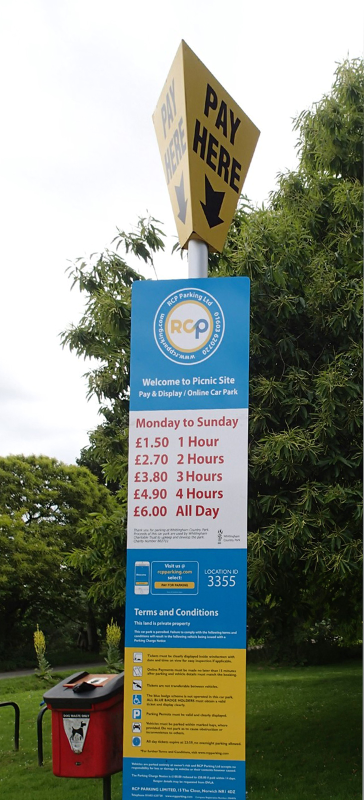
Parking. At the beginning of Whitlingham Lane there is free parking, but limited to 2 hours between 8 AM and 6 PM. Further along the lane there is a stretch of free parking. Then further along there are car parks with charges, currently (July 2019) from £1.50 for one hour to £6 all day. Or you can get an annual season ticket, full price £40 a year.
An account of Trowse Sept swims
[swim log 904, 947-951, 985, 986 … 1070-1079]
Please note: all swims are at our own risk. Including a location does not indicate that it is recommended or that it is safe; each must do their own risk assessment each time they swim or travel to a location. I accept no liability for the choices that people make. There is Swim Safety info on this website, and on Outdoor Swimming Society website, Survive section.
Please follow the Outdoor Swimmers Code, and Outdoor Swimming Society advice on responsible swimming at this time.