We organised a workshop 11 March 2020 at the start of the Healing Waters project, to bring together local landowners, land managers and local authorities with members of landowner organisation VSG, local swimmers and those managing the project to share advice on outdoor swimming and visitor safety.
The project is part of a wider set of projects, The Brecks Fen Edge & Rivers Landscape Partnership Scheme (BFER), supported by the National Lottery Heritage Fund.
Download a report of the day (Word.doc 4 pages), which also includes more information on workshop organisers and speakers and a list of resources and guidance.
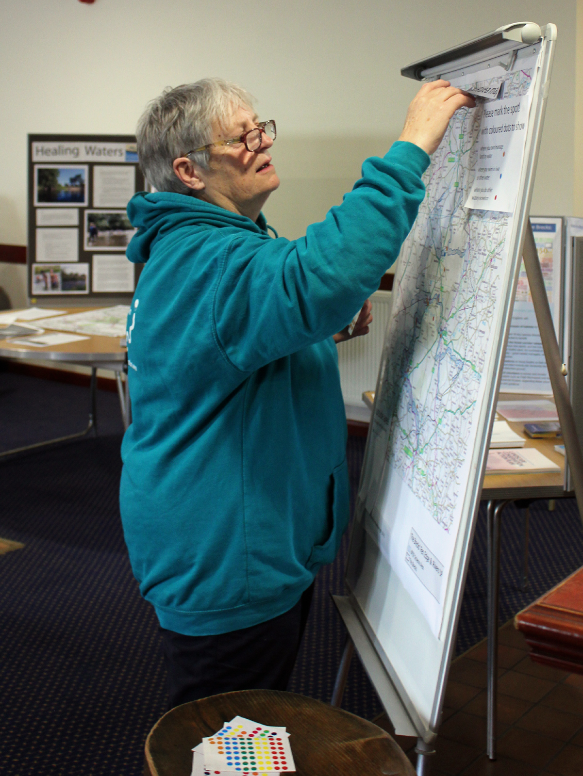
Participants put spots on the map of the Brecks to show where they owned or managed or had a responsibility for land, and where they have swum or done any other outdoor activity.
Download a spreadsheet of the owned and swum places on the map (.xls)
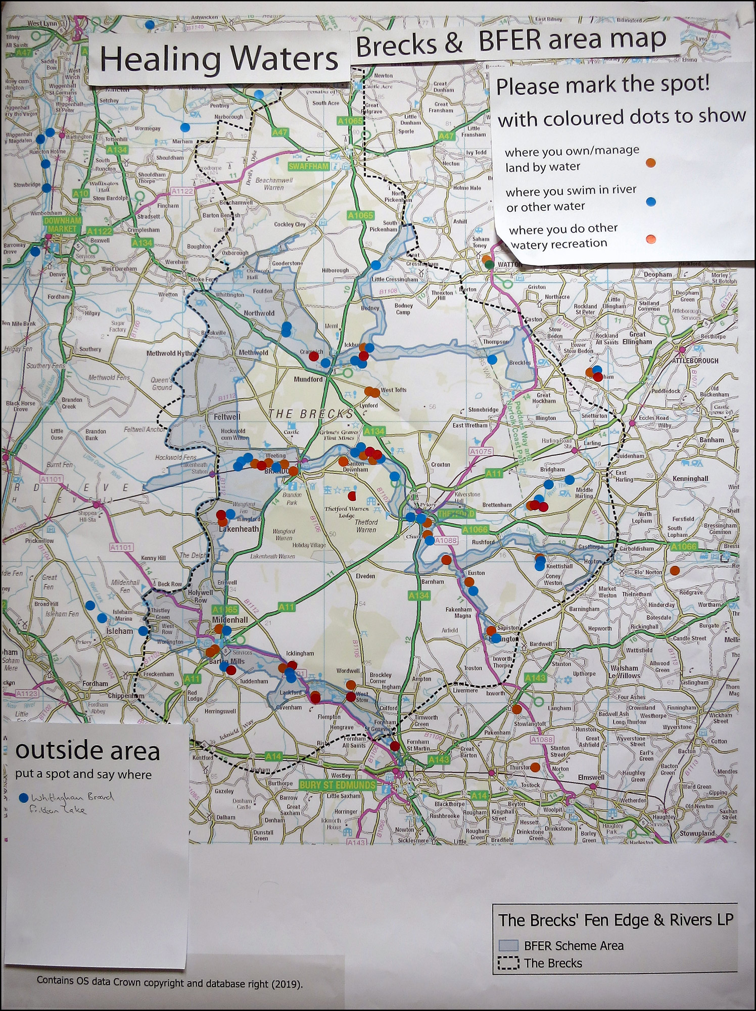
A year earlier participants at The Brecks Fen Edge & Rivers Landscape Partnership Scheme Conference 13 March 2019 also put spots on a map to show the wide range of recreation in the Brecks rivers and other waters.