See Itinerary for S Suffolk Swims 21 22 Sept, and read Quick report of the trip
Please note: all swims are at our own risk. Including a location does not indicate that it is safe; we must do our own risk assessment. Swim Safety info on this website.
Most swims are most easily reached by car, and some have no public transport route. Some are near railway stations, though. I’ve indicated this at the end of each entry.
Sat 21 Sept
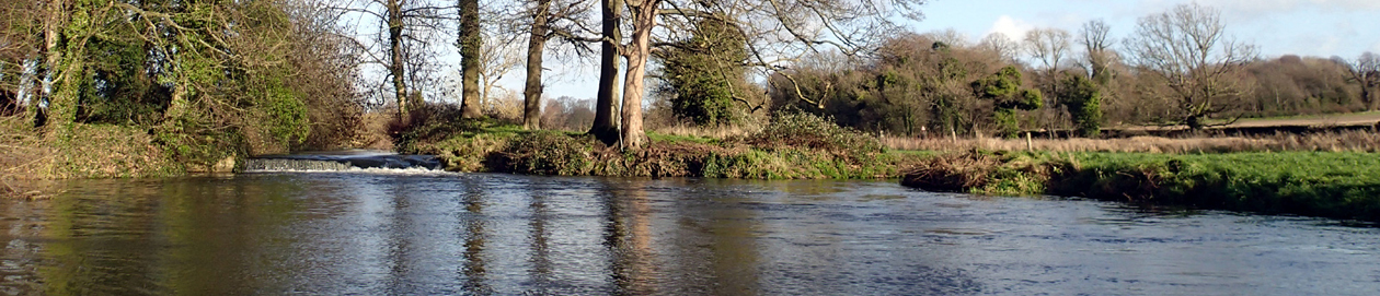
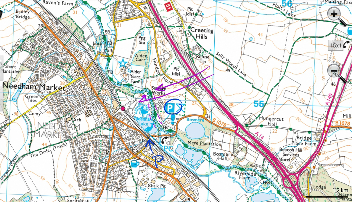
07.45 Needham Market
From the main car park, cross the river, or from the smaller car park walk to the river, turn and follow the river upstream. There are various pools, the best a shallow but clear pool on a bend, with a rope swing. The lake looks shallow and uninviting, even before you see the signs that forbid swimming and much else. There is a railway station.
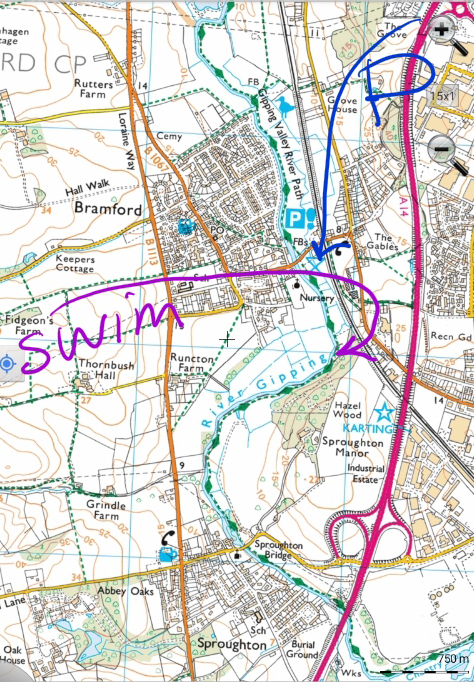
08.45 Bramford
Park in the car park, walk down to the river. You can have a dip or paddle here. Or walk along the riverbank to where the woods starts, and that is one possible entry point, alternatively continue along the riverside path in the wood and enter by the rope swing, or any suitable place down the bank. It is usually clear of weeds under the trees. Buses from Ipswich go to nearby Westbourne or Sproughton.
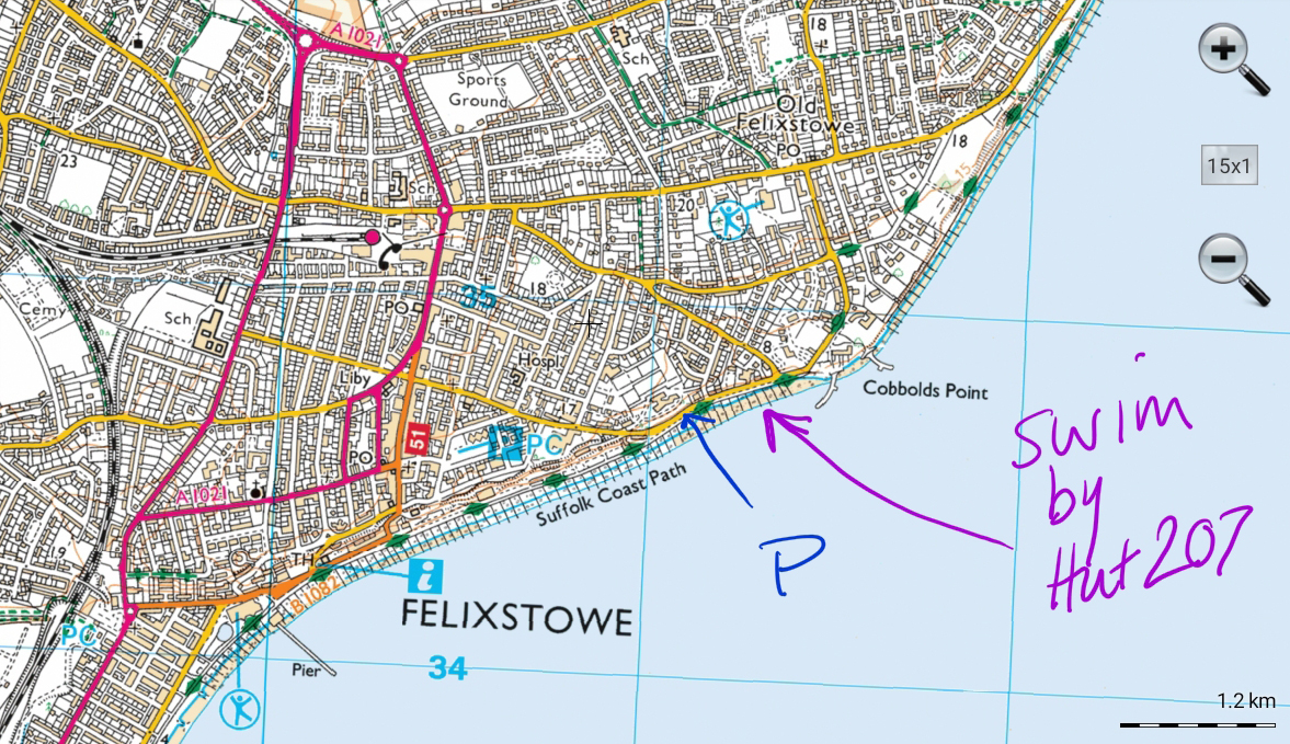
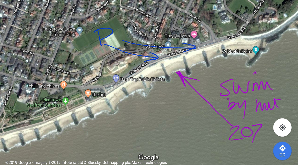
10.30 Felixstowe with Swimscapes
Park anywhere along the front. Meet at Hut 207, not far from Fludyers hotel, where swimmers congregate for longer swims or dips, there is tide and temperature information and a friendly welcome. IP11 7LS. On Wild swim map. There is a railway station.
12.00 Fore Street Baths, Ipswich
This is an indoor heated pool, but a wonderful historic building, and they do have a cold shower! Opening times are limited, eg Saturday 12-13.50, 15.00-5.00. Ipswich is on a main rail route.
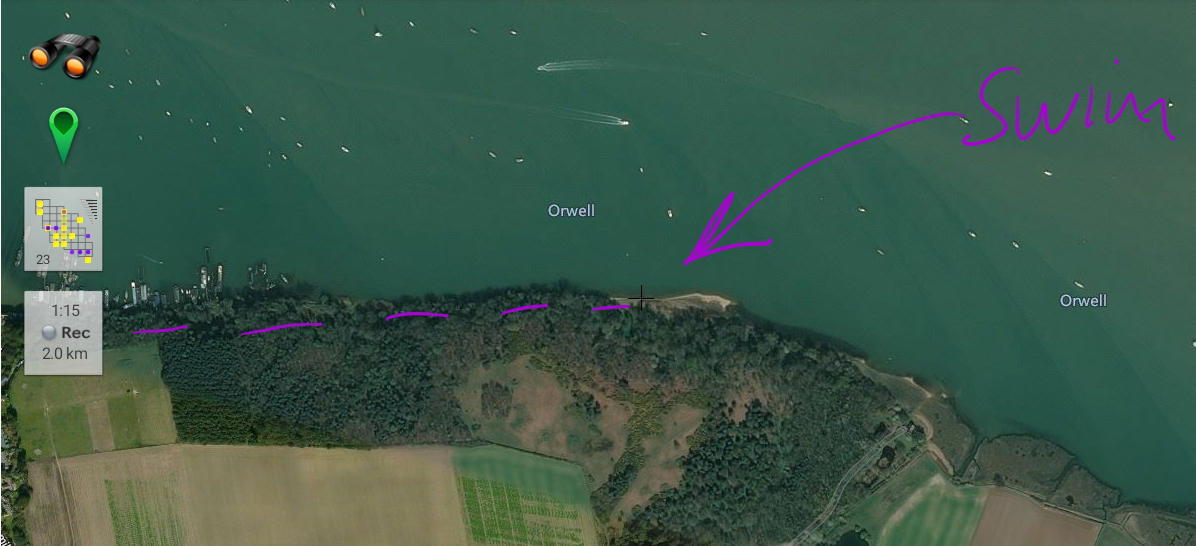
13.00 Chelmondiston Pin Mill with Swim Walks
Park about 1245, walk to the right along the coastal path to the point on the map, where I swam with the Swim Walks Facebook group who walked from the ferry from Harwich Town Station.
You can swim when tide low, only slightly muddy entry, and that makes walking to the beach easier. Easiest is to walk along the upper path through the wood and at the end go down to the river. The marked beach involves a walk along the shoreline.

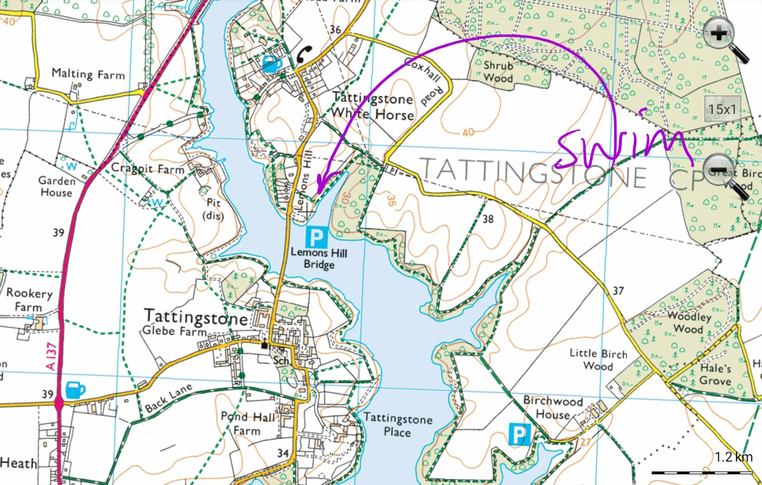
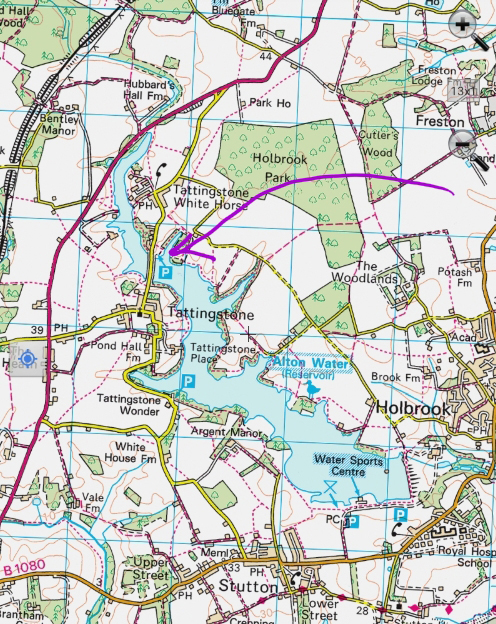
14.30 Alton Water
Park Lemons Hill, admire the no swimming signs and consider whether you want to risk a level 2 fine. You can either go just down a little path to the beach, or take the footpath along the inlet to find a more secluded entry point (an exploration). Best not to swim too far out into the lake, and avoid colourful swim hats and tow floats etc to minimise chance of detection. There is a bus from Ipswich railway station.
15.30 Stratford St Mary
Park in the tiny space opposite Le Talbooth, or at the restaurant, walk through the tunnel under the road, through a gate and along the footpath to a small fenced tree where it is easy to get in. There is a bus from Ipswich.

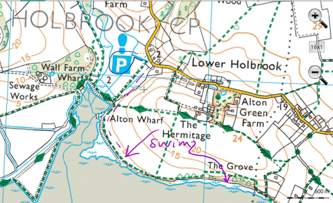
16.45 Lower Holbrook
Park in the village car park, walk to one of the beaches marked on the map. Swim around high tide, otherwise it is a long walk out. It is shallow even at high tide, but soon swimmable. There is a bus from Ipswich rail station.

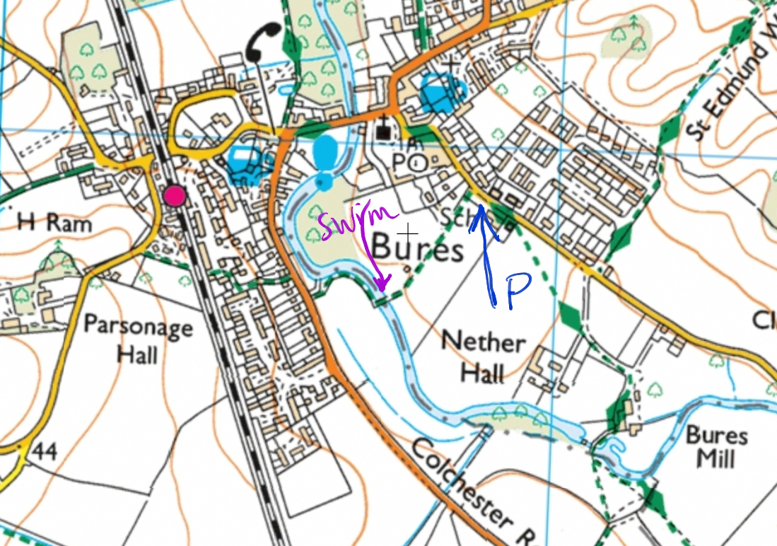
1745 Bures
Although it is Suffolk Swims, it is easier to get in a muddy beach on the south (Essex) side of the river. You can park on the verge on that side, or in the community centre car park on the Suffolk side, then just walk down past the play equipment etc to the river. There is a bus from Colchester, or rail from there, Marks Tey or Sudbury.
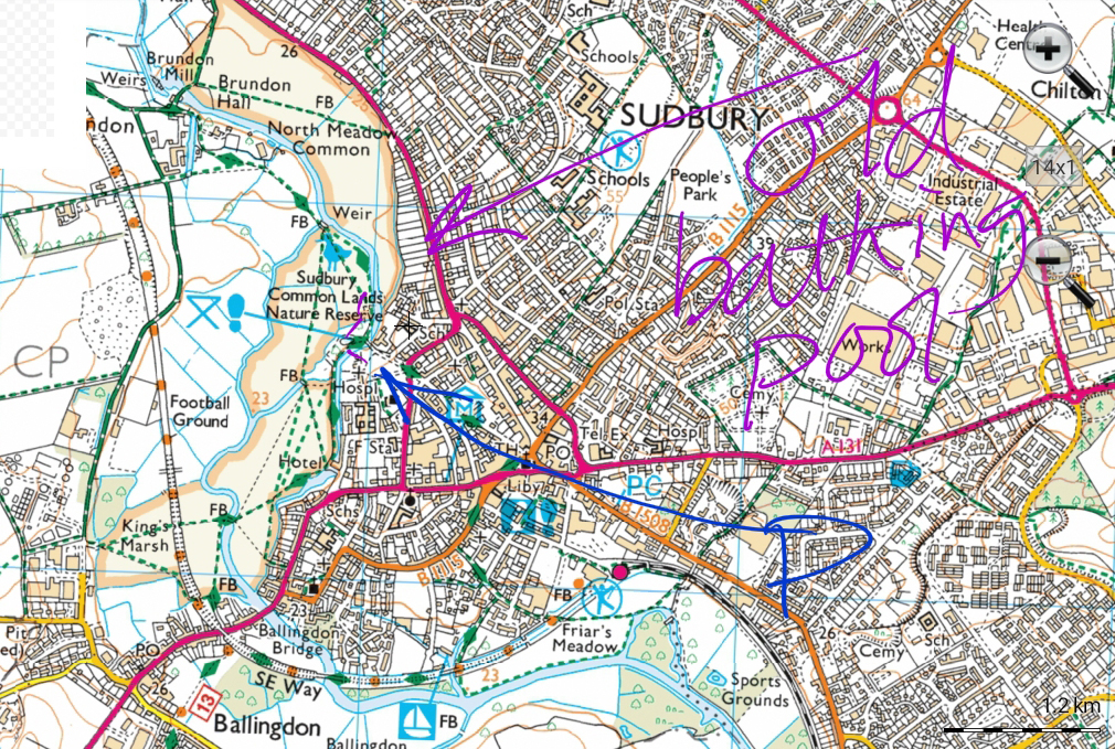
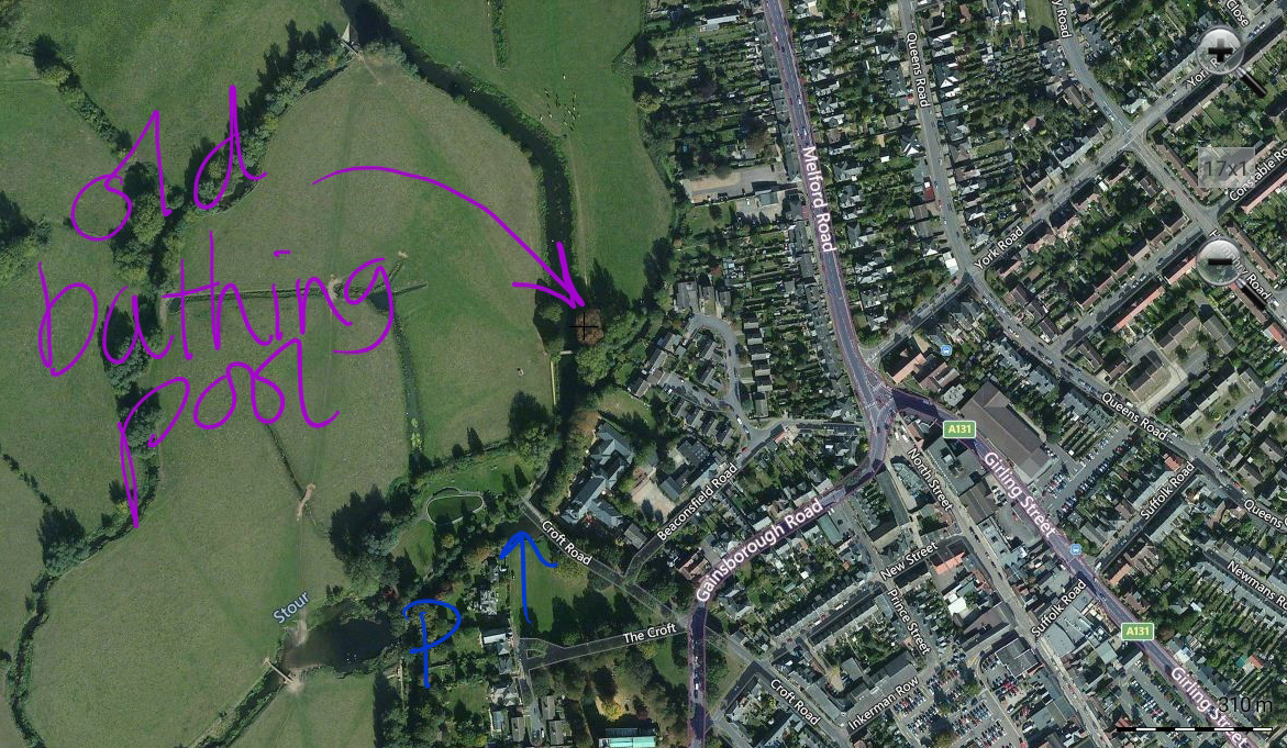
18.30 Sudbury – paddle in Old Bathing Place
Park at the end of Croft Road, cross the footbridge and turn right along the riverbank until you see the two large trees with shaped stone banks on either side. Cross the footbridge, and it should be possible to paddle under the trees (shoes recommended). There is a railway station.
I found out about this place in the wonderful book byJustin Minns, Photographing East Anglia (p378)
Sun 22 Sept
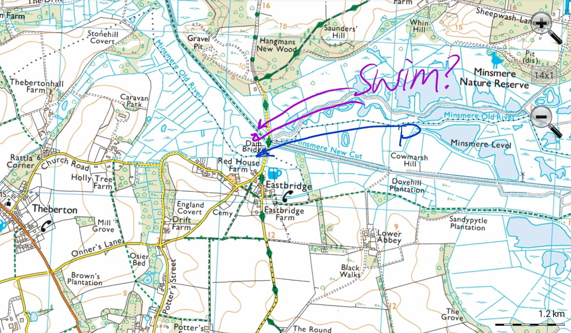
08.45 Eastbridge
Park by the Minsmere river, walk along the north bank a little way to a sluice structure where you should be able to get in, or similar on the other bank. Water levels and weeds might make it not possible to swim, especially late summer and autumn. No public transport, but a nice area to walk or cycle, and there is a campsite.
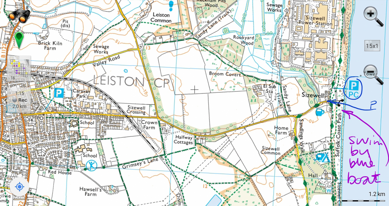
10.00 Sizewell
If you can, park on the road before or just after it turns left. From there, walk down to the sea and look for a large blue boat, as a landmark to swim near to (and shelter from the breeze). But you can swim anywhere. Tides don’t matter, except that you can sometimes walk to the sandbank at low tide. No public transport, but a nice area to walk or cycle.
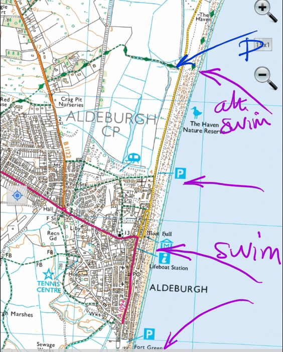
11.30 Aldeburgh
You can swim anywhere along this stretch of coast. Popular options on the map, including by the Maggie Hambling shell which kids of all ages enjoy playing on. Or park anywhere in the town, and go down to the sea by the Moot Hall. Or to Slaughden. Or drive or walk towards Thorpeness and park opposite a little tumbledown cottage, walk down to the sea to swim. There is a bus from Saxmundham.
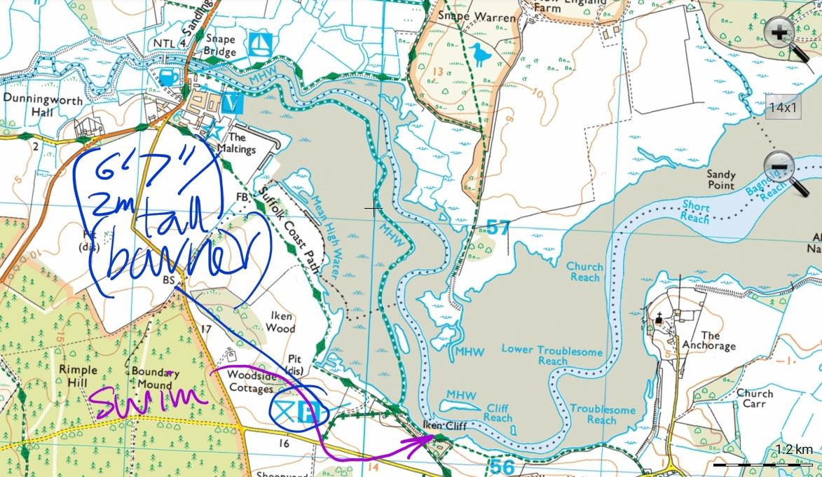
13.00 Iken Cliff
From the car park – note barrier 2m – walk away from Snape, to the right, to the canoe hire place. Swim at high tide, so not too much muddy walking into the water. Unless you know what you are doing don’t go too far out into the tidal river. You can also park along the road and walk down a footpath, or from Snape Maltings. There is a bus from Saxmundham.
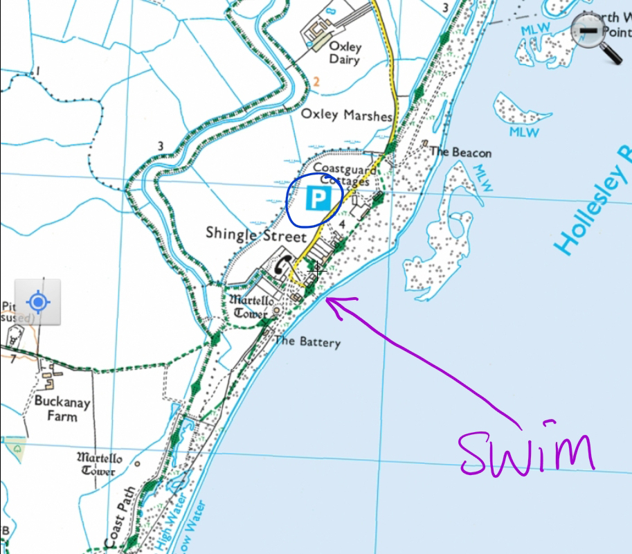
14.30 Shingle Street
The beach shelves steeply. You can swim opposite the end of the lane or anywhere nearby. Don’t go out beyond the buoys, as the currents are fierce and will drag you out to sea. It appears in a list of Suffolk’s Top Secret Beaches, along with Covehithe, so presumably they are no longer secret! No public transport route.
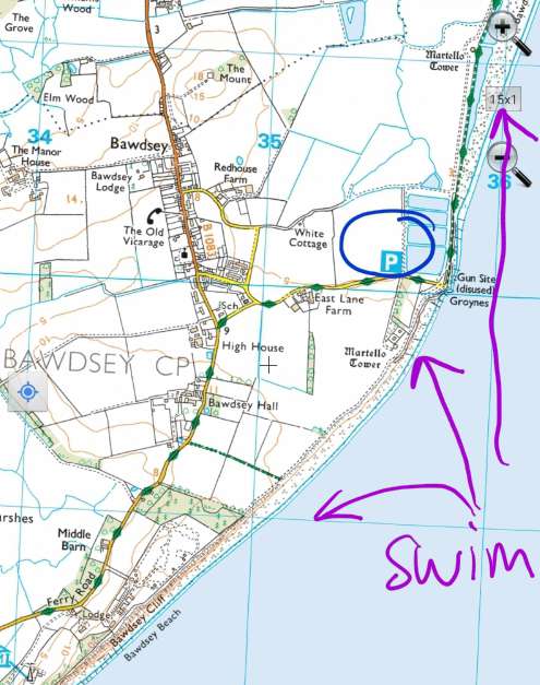
15.30 East Lane, Bawdsey
Walk along to the right /south or to the left/north for the beaches. Atmospheric gun site with rocky point – don’t swim there, but go along to the beach. I didn’t swim here but others have recommended it. No public transport.
16.45 Ufford
There is a layby near the three bridges, or the pub car park further up the road. Below the bridge is shallow entry then a small but very deep pool. There is a bus from Woodbridge.
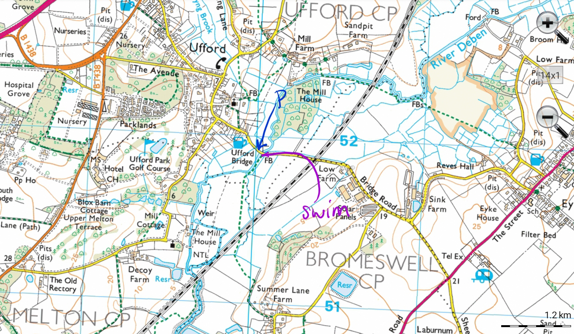
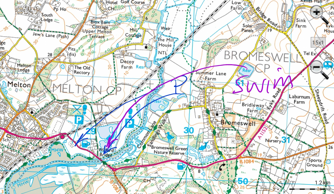
17.30 Wilford Bridge
Swim around high tide. I swam at 17.30-17.45 and the tide was starting to go out, though high tide for Woodbridge was supposed to be 18.35. Ideally the water would be slack or at least not going out fast. Tidal rivers sometimes just have to be judged at the time.
It’s possible to park in a small car park right next to the bridge, or in the larger one on the opposite side of the road. Walk down from the car park on the upriver side of the bridge where there are some steps which might be very slippery, or further upstream a couple of sluice structures which could be used for entry. Very near to railway station.
18.45 Parham
On the day I said people could contact me for details of this location. No further info availble.
See Itinerary for S Suffolk Swims 21 22 Sept
Please note: all swims are at our own risk. Including a location does not indicate that it is safe; we must do our own risk assessment. Swim Safety info on this website.